The New Atlas And Commercial Gazetteer Of China; A Work Devoted To Its Geography & Resources And Economic & Commercial Development. Containing 25 Bi-Lingual Maps, With Complete Indexes, And Many Coloured Graphs. Compiled and Translated from the latest and most authoritative surveys and records by the staff of the Far Eastern Geographical Establishment, Shanghai, China
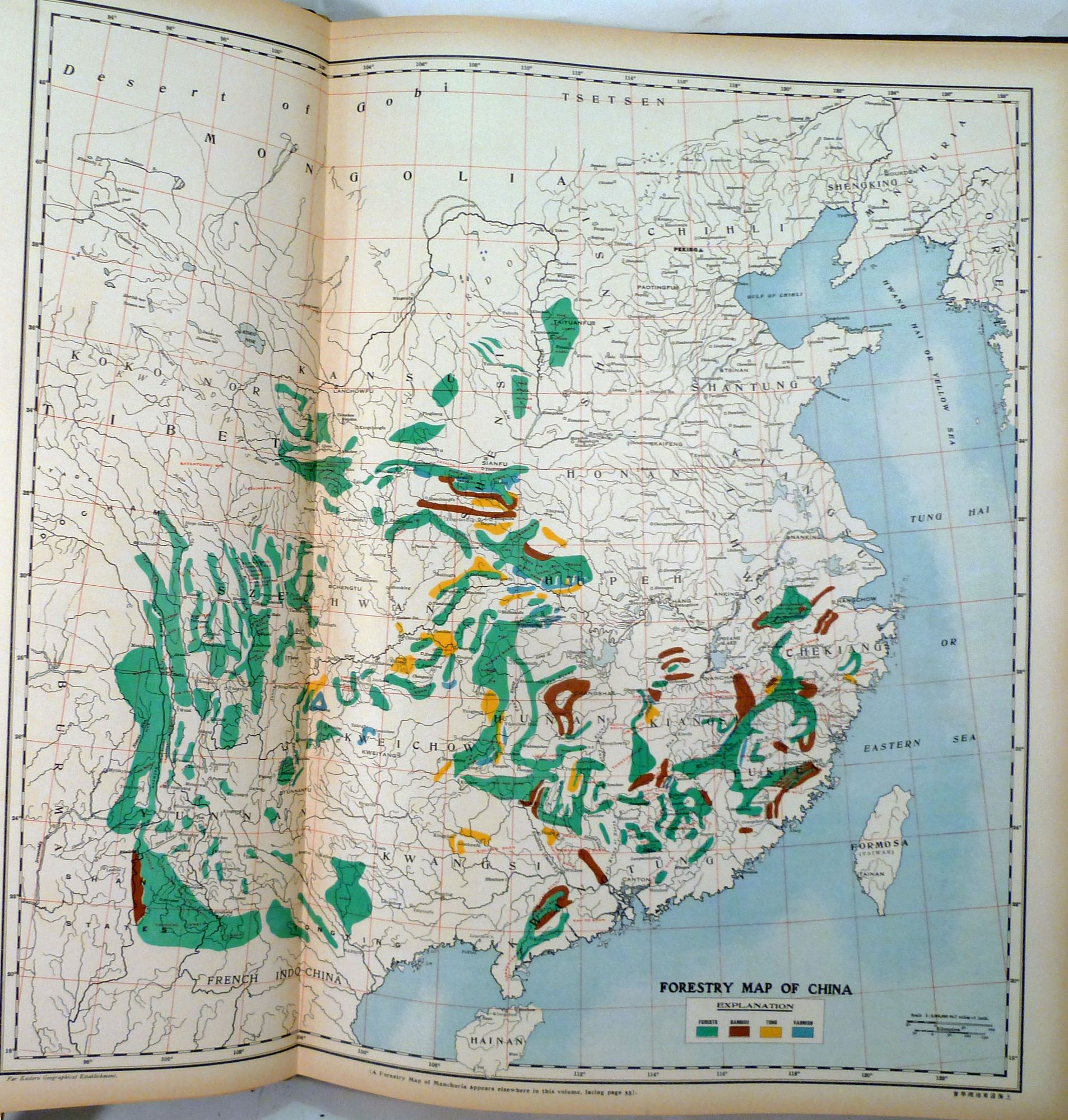
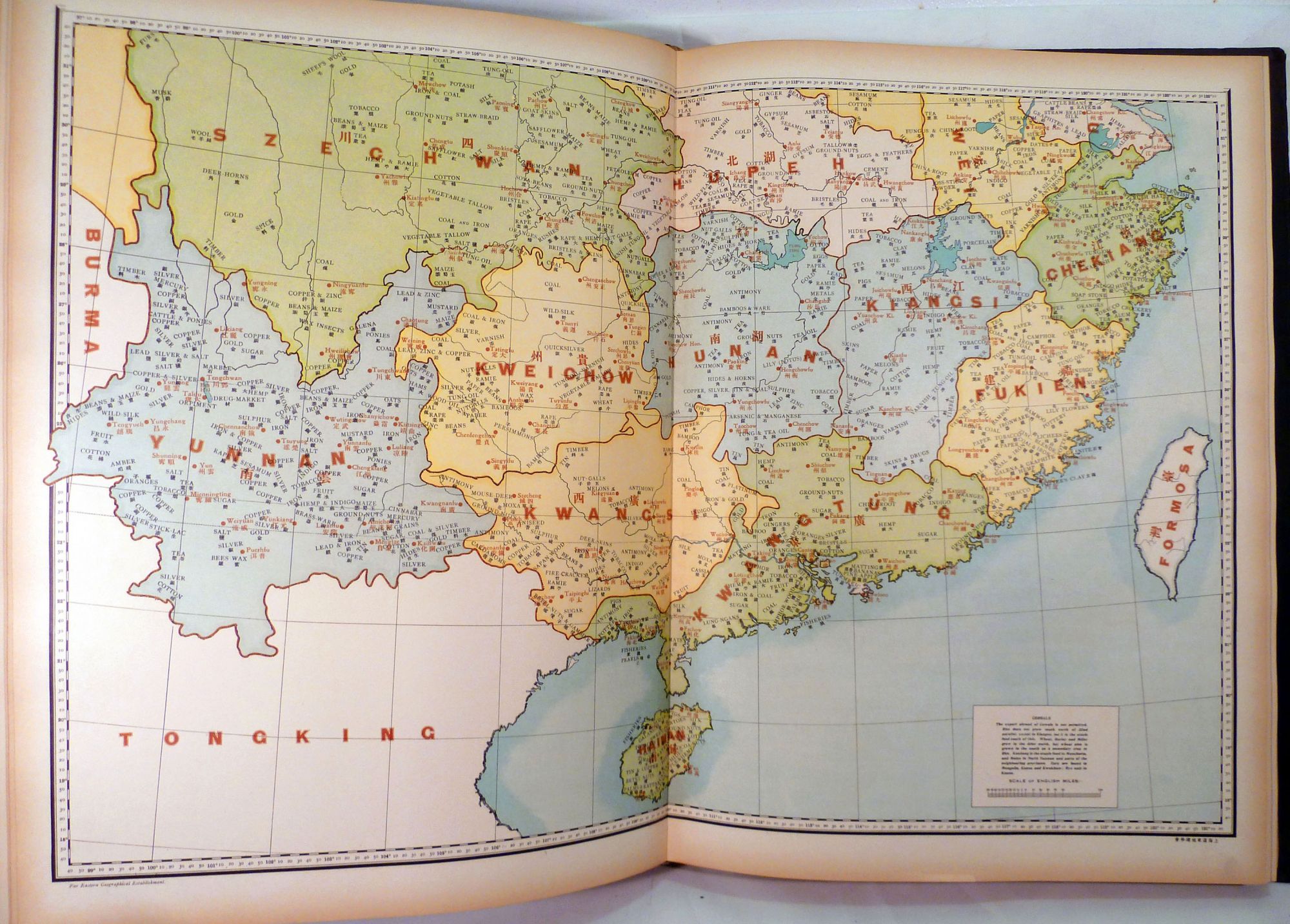
Shanghai: North China Daily News & Herald Ltd, (1917). Second edition. leather_bound. Elephant folio, 53.5 x 38.7 cm. 18 colored graphs and diagrams ; 26 colored maps and two half page colored maps -- all are color lithographs. The largest, most comprehensive atlas of China in English so far published to that date. It contains detailed surveys of Chinese geography, commerce, economics and education, a trade research section, and sections on Chinese production, railways, communications, forestation, geology, fauna and flora. The commercial section presents detailed information on China's exports and imports: the opium, silk, tea and treasure trades. Also of special note is a a list of the "Principal commodities of the World's economic and commercial development of China." -- Maps: no. 1. Chihli. -- no. 2. Shantung. -- no. 3. Honan. -- no. 4. Shansi. -- no. 5. Shensi. -- no. 6. Kansu. -- no. 7. Szechwan. -- no. 8. Hupeh. -- no. 9. Hunan. -- no. 10. Kiangsi. -- no. 11 Anhwei. -- no. 12. Kiangsu. -- no. 13. Chekiang. -- no. 14. Yunnan. -- no. 15. Kweichow. -- no. 16. Kwangsi. -- no. 17. Kwangtung. -- no. 18. Fukien. -- no. 19. Manchuria. -- no. 20. Sinkiang. -- no. 21 Mongolia. -- no. 22. Tibet. -- no. [23] Forestry map of China. -- no. [24-25] New productions map of China. -- no. [26] Railway map of China. Inset: Sketch map of Manchuria. Preface to the Second edition, "The New Atlas and Commercial Gazetteer of China seeks to give information that is essential to the business-man in regard to a country that comprises nearly a sixth of the earth's surface, a country that has the world's largest and most heterogeneous population in the world, a country which less is known than in regard to any similar area in the world." institutional stamp and bookplate. Interior contents clean and bright. Orig. publisher's gilt lettered, blind stamped black morocco. Very good. Item #21068
Price: $7,950.00